Boston Walking City Trails — stop photo 1
Boston Walking City Trails — stop photo 2
Boston Walking City Trails — stop photo 3
Boston Walking City Trails — stop photo 4
crossing · point to point

Boston Walking City Trails

Boston, Massachusetts, United States

Boston Walking City Trails — stop photo 1
Boston Walking City Trails — stop photo 2
Boston Walking City Trails — stop photo 3
Boston Walking City Trails — stop photo 4
Boston Walking City Trails — stop photo 5
Boston Walking City Trails — stop photo 6
Boston Walking City Trails — stop photo 7

About this journey

The Boston Walking City Trails are a 58-mile urban hiking network connecting 75+ green spaces across 23 Boston neighborhoods. The network includes the original 27.4-mile Walking City Trail running from the Neponset River to Bunker Hill Monument, plus the 31.1-mile City On The Hills Trail from West Roxbury to Castle Island. These transit-accessible trails showcase Boston's parks, gardens, historic sites, and diverse neighborhoods while following the city's walkable heritage. Founded in spring 2022 by Bostonians with a shared passion for wandering, the trails can be completed in segments or as multi-day urban adventures, offering everything from Freedom Trail history to harbor views and hidden neighborhood gems.

Quick facts

stops
29located
shape
crossing
total distance
27 miles
best season
Anytime
avg completion
2-5 days

Loading your progress…

loading map…

The journey, stop by stop

stop 1 of 29
photo not yet sourced

Harvest River Bridge

Harvest River Bridge is a scenic pedestrian crossing along the Neponset River, offering views of the water and surrounding marshland. As part of the Neponset River Greenway, the bridge connects trails on both sides of the river, enabling a continuous walk through some of Boston’s most peaceful and ecologically rich landscapes. 

stop 2 of 29
photo not yet sourced

Sherrin Woods

Sherrin Woods is a forested pocket of urban wilderness tucked between Mattapan and Hyde Park. With its rugged trails, rock outcrops, and tall trees, it’s a quiet spot that feels far removed from the city. Trails here are often narrow and unmarked, giving walkers a more adventurous, exploratory feel. 

stop 3 of 29Stony Brook Reservation

Stony Brook Reservation

Stony Brook Reservation is a sprawling natural preserve in Hyde Park with over 12 miles of trails through forests, hills, ponds, and meadows. It’s one of Boston’s wildest public areas, offering challenging hikes, peaceful lakeside views, and wooded solitude. The reservation includes Turtle Pond, a popular fishing and picnic spot, and numerous unpaved trails for a more rugged hiking experience. 

stop 4 of 29
photo not yet sourced

Sherman Street Green Space Conservancy

This small green space in the Hyde Park neighborhood is a community-led project focused on conservation and native plant restoration. While compact, it features pathways, wildflower meadows, and environmental signage, making it a stop that emphasizes sustainability and local engagement. It offers a quiet place to reflect and reconnect with nature on Boston’s southern edge. 

stop 5 of 29
photo not yet sourced

Adams Park

Located in Roslindale Village, Adams Park is a small community green space that serves as a local gathering point with benches, shade trees, and a seasonal farmers market. While modest in size, its central location makes it a practical rest stop or meeting point on the City Trails. The park is surrounded by cafés, shops, and transit access, blending green space with urban convenience.

stop 6 of 29Arnold Arboretum

Arnold Arboretum

The Arnold Arboretum is a world-renowned botanical garden and research facility managed by Harvard University. Covering 281 acres in Jamaica Plain and Roslindale, it showcases thousands of tree and plant species from around the world. Walking trails weave through curated landscapes, open meadows, and wooded hills, including the popular climb to Peters Hill for panoramic views.

stop 7 of 29
photo not yet sourced

Southwest Corridor Park

Stretching 4.7 miles from Forest Hills to Back Bay, the Southwest Corridor Park is a linear park built atop a former rail corridor. It’s now a lively ribbon of walking and biking paths, community gardens, playgrounds, and sports courts. The trail winds through several Boston neighborhoods, linking parks, transit stations, and local murals. 

stop 8 of 29Franklin Park

Franklin Park

Spanning over 500 acres, Franklin Park is Boston’s largest green space and the crown jewel of the Emerald Necklace. It features forests, playing fields, trails, a golf course, and the Franklin Park Zoo. Designed by Frederick Law Olmsted, it’s a sprawling blend of wild woods and manicured lawns, perfect for long walks, picnics, or exploration.

stop 9 of 29
photo not yet sourced

Parley Vale Woods

Parley Vale Woods is a quiet, lightly trafficked woodland nestled in Jamaica Plain, offering a rustic escape with short, unpaved trails through tall trees and thick underbrush. A lesser-known gem, it’s ideal for walkers seeking solitude, birdsong, and an untamed pocket of nature within the city. The trail winds along gentle hills, connecting nearby neighborhoods and green spaces.

stop 10 of 29Jamaica Pond

Jamaica Pond

Jamaica Pond is one of Boston’s most beloved natural features, offering a 1.5-mile walking loop around its glacial lake. Framed by trees and gentle slopes, the pond is a favorite for walking, jogging, fishing, and paddle boating. It’s the largest body of freshwater in the Emerald Necklace and a central part of Frederick Law Olmsted’s design.

stop 11 of 29
photo not yet sourced

Olmsted Park

Part of the famed Emerald Necklace, Olmsted Park is a tranquil, linear park stretching between the Riverway and Jamaica Pond. Designed by Frederick Law Olmsted, it features winding trails, woodlands, and three serene ponds—Ward’s, Willow, and Leverett. The park’s meadows and shady paths invite walkers, joggers, and birdwatchers to unwind in nature while still in the city. 

stop 12 of 29
photo not yet sourced

NIRA Rock

NIRA Rock Urban Wild is a hidden gem in Jamaica Plain—an outcrop of glacial rock surrounded by woods, gardens, and steep walking paths. This once-neglected site is now a cherished green space with community-built trails and native plantings. The rocky summit offers modest views and a satisfying scramble for those on foot.

stop 13 of 29
photo not yet sourced

McLaughlin Woods

Tucked away in Mission Hill, McLaughlin Woods is a small forested park perched above the city, offering shaded trails, birdwatching, and moments of peace. Its winding dirt paths and modest elevation give walkers a brief but welcome dose of nature in an otherwise dense neighborhood. It’s a great connector between hilltop green spaces and a quiet retreat from surrounding streets

stop 14 of 29
photo not yet sourced

Mission Hilltop

Mission Hilltop refers to the elevated section of the Mission Hill neighborhood, known for its steep streets, historic architecture, and commanding city views. While not a formal park, this part of the trail offers a challenging urban ascent with visual payoffs, leading walkers past brick rowhouses, community gardens, and mural art.

stop 15 of 29
photo not yet sourced

Kevin W. Fitzgerald Park

Located in the Mission Hill neighborhood, Kevin W. Fitzgerald Park is a hilltop green space with panoramic views of downtown Boston. Formerly a concrete lot, the park was transformed into a multi-level community oasis with walking paths, benches, and open lawns. Its elevated position makes it a rewarding rest stop or scenic detour on the trail, offering skyline views, especially at sunset

stop 16 of 29
photo not yet sourced

The Riverway

Winding from the Back Bay Fens to Olmsted Park, The Riverway is a wooded linear park that follows the Muddy River. Designed by Olmsted as part of Boston’s Emerald Necklace, this narrow, shaded trail offers a natural escape within the city. Footbridges, stone walls, and densely wooded paths provide a peaceful and immersive walk, ideal for nature lovers.

stop 17 of 29
photo not yet sourced

The Fens

Part of the Emerald Necklace park system, The Fens is a diverse urban wetland and parkland offering scenic walking trails, gardens, and historic landmarks. Originally designed by Frederick Law Olmsted to manage tidal flooding, it’s now a lush oasis with native plantings, the Kelleher Rose Garden, and meandering waterways. 

stop 18 of 29
photo not yet sourced

Fenway Victory Gardens

The Fenway Victory Gardens, founded during World War II, are the oldest continuously operating Victory Gardens in the U.S. Tucked within the Back Bay Fens, these 500+ garden plots are lovingly tended by local residents and form a vibrant, living mosaic of flowers, vegetables, and creative expression. Walking paths wind through the gardens, offering a glimpse into community spirit and urban agriculture.

stop 19 of 29
photo not yet sourced

Commonwealth Avenue Mall

The Commonwealth Avenue Mall is a tree-lined promenade running through Boston’s Back Bay, offering a green spine of shade and sculpture between stately brownstones. This historic stretch features wide walkways flanked by benches and statues honoring figures like Alexander Hamilton and Samuel Eliot Morison.

stop 20 of 29Esplanade Park

Esplanade Park

Stretching along the Charles River between the Longfellow and BU bridges, the Esplanade is one of Boston’s most beloved linear parks. With miles of walking and biking trails, docks, playgrounds, and picnic areas, it offers sweeping river views and skyline backdrops. The Hatch Shell hosts concerts and events, making the park a hub of cultural life as well as a tranquil escape. 

stop 21 of 29Boston Public Garden

Boston Public Garden

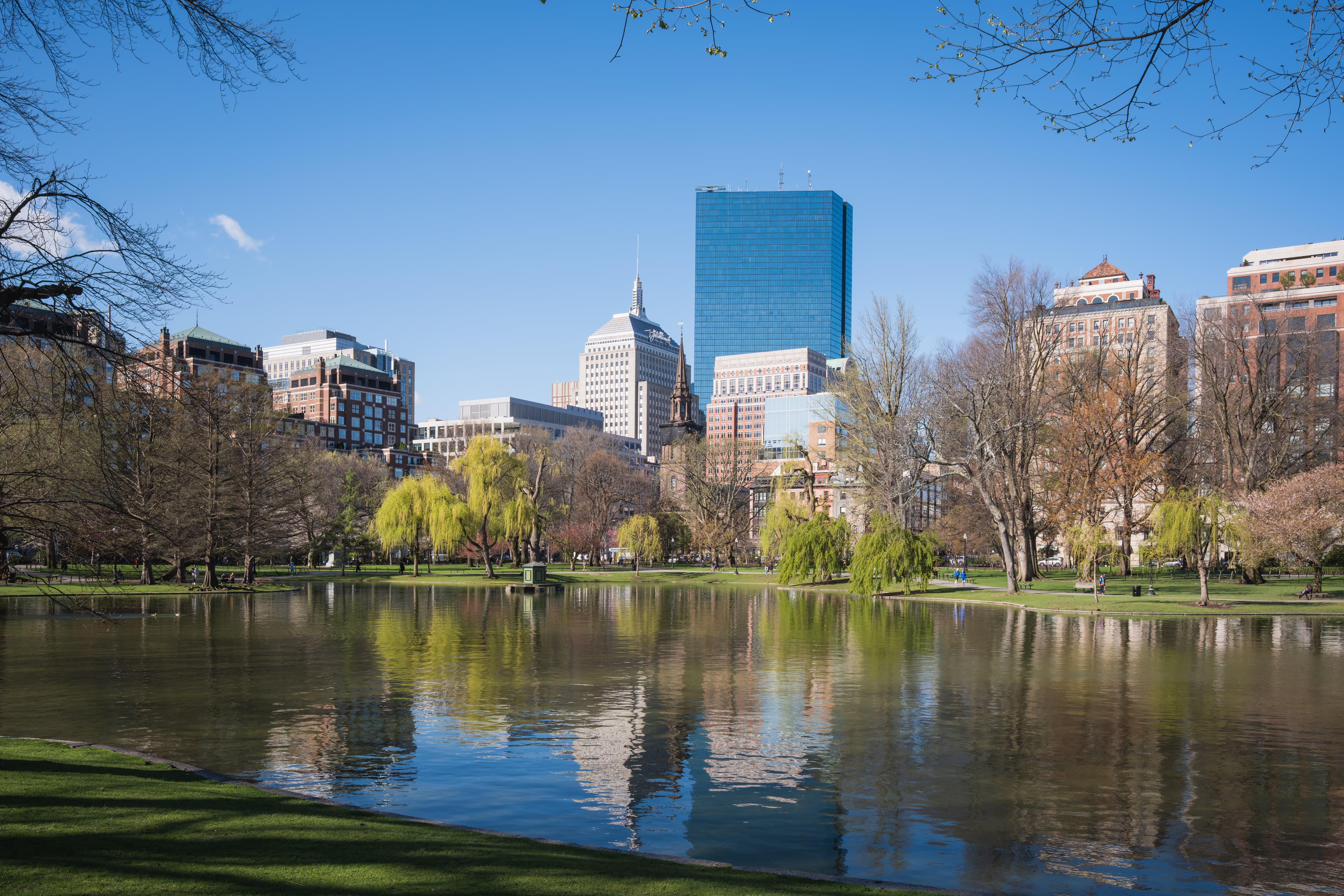
Directly adjacent to Boston Common, the Boston Public Garden is a lush Victorian-era landscape featuring formal flower beds, winding pathways, and the famous Swan Boats. Founded in 1837, it was the first public botanical garden in America. Its footbridges, statues, and lagoon make it one of the city’s most romantic and relaxing green spaces. 

stop 22 of 29Boston Common

Boston Common

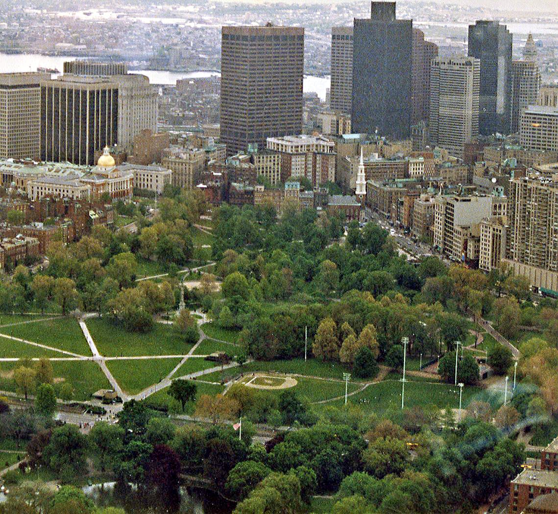
America’s oldest public park, Boston Common is a central landmark on both the Freedom Trail and Boston City Trails. Established in 1634, this sprawling green space has served as a pasture, military training ground, and protest site. Today, it offers broad lawns, paved walking paths, a frog pond, and monuments that reflect centuries of civic life. 

stop 23 of 29Winthrop Square

Winthrop Square

Nestled in Boston’s Financial District, Winthrop Square is a small, historic plaza that offers a quiet pause amid the urban rush. The square is named after John Winthrop, Massachusetts' first governor, and features a prominent bronze tablet honoring him. 

stop 24 of 29
photo not yet sourced

Martin’s Park

Martin’s Park is a vibrant, inclusive playground and green space on the South Boston waterfront, built in memory of Martin Richard, the youngest victim of the 2013 Boston Marathon bombing. Designed for all abilities, the park features wooden play structures, native plantings, and waterfront views. 

stop 25 of 29
photo not yet sourced

Boston Harbor Walk

The Boston Harborwalk is a scenic, urban waterfront trail stretching for miles along the city’s shoreline. Connecting parks, wharves, museums, and neighborhoods, this trail offers walkers ever-changing views of the harbor, historic ships, and public art. From the Seaport to Charlestown, the path winds past landmarks like the Boston Tea Party Museum and Christopher Columbus Park. 

stop 26 of 29Paul Revere Mall

Paul Revere Mall

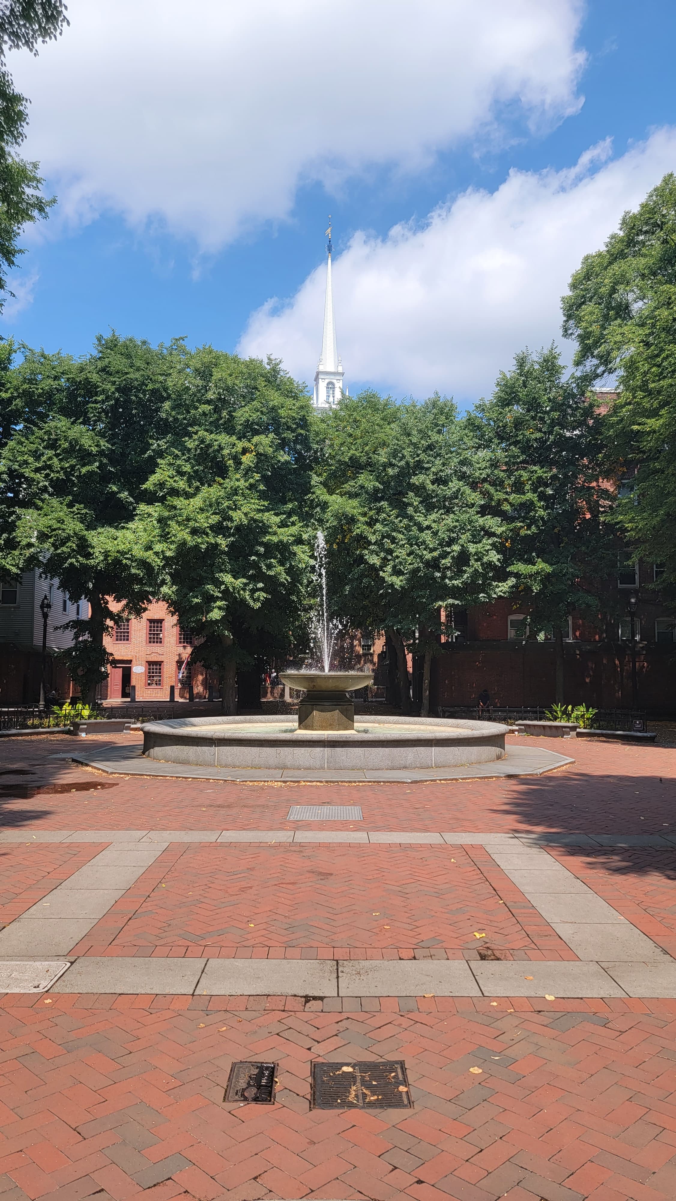
Also known as “The Prado,” Paul Revere Mall is a historic brick-lined promenade in Boston’s North End. Framed by trees and Italian-style lamp posts, this narrow park features a striking equestrian statue of Paul Revere and connects to the Old North Church.

stop 27 of 29
photo not yet sourced

Charter Street Park

Charter Street Park sits quietly in the North End, a historic neighborhood known for its cobblestone streets and Italian heritage. This small, shaded park lies beside Copp’s Hill Burying Ground, one of Boston’s oldest cemeteries, offering a serene place to rest and reflect while exploring the Freedom Trail or nearby historic sites.

stop 28 of 29
photo not yet sourced

Paul Revere Park

Located on the banks of the Charles River in Charlestown, Paul Revere Park is a scenic green space with panoramic views of the Zakim Bridge and downtown skyline. A popular rest stop on the Walking City Trail, the park honors the legendary midnight rider and connects to several waterfront trails and bike paths. Wide walkways, grassy lawns, and a riverside boardwalk make it ideal for walkers, joggers, and families.

stop 29 of 29Bunker Hill Monument

Bunker Hill Monument

Easy

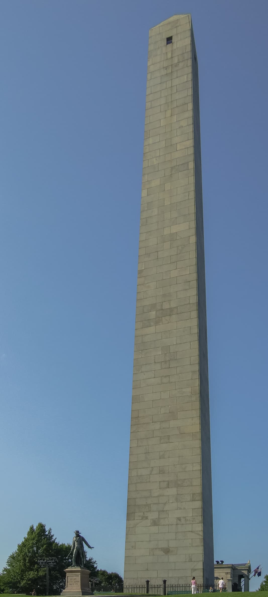
The Bunker Hill Monument, located in Boston, Massachusetts, commemorates one of the first major battles of the American Revolutionary War—the Battle of Bunker Hill in 1775. This 221-foot granite obelisk stands on Breed’s Hill, where colonial forces faced off against the British in a fierce fight that demonstrated American determination and resilience. 

History and Geology

The Boston Walking City Trails connect modern urban hikers with over 400 years of American history, from the Puritan settlement of 1630 through the Revolutionary War, Industrial Revolution, and contemporary urban development. The trails deliberately incorporate many of Boston's most significant historical sites, including locations where key events in American independence occurred. Boston's iconic 2.5-mile Freedom Trail connects 16 nationally significant historic sites, which intersects with portions of the Walking City Trail network, providing additional historical context for urban hikers. The network celebrates Boston's evolution as America's "Walking City," a designation that reflects both the city's compact scale and its pedestrian-friendly design principles that date back to colonial street patterns. The trails also highlight Boston's remarkable immigrant history, passing through neighborhoods that have welcomed waves of Irish, Italian, Chinese, Latino, and other communities who shaped the city's character. This cultural diversity remains visible today through architecture, local businesses, community centers, and public art that the trails intentionally showcase. The Boston Walking City Trails traverse a geologically fascinating urban landscape shaped by glacial activity, harbor formation, and centuries of human land modification. The underlying geology consists primarily of glacial deposits left by retreating ice sheets, creating the rolling hills and filled valleys that define Boston's topography. The trails cross several distinct geological zones, from the original Shawmut Peninsula where Boston was founded to extensive landfill areas that expanded the city into Boston Harbor.

Safety

Weather protection for Boston Walking City Trails requires versatile urban hiking gear suitable for New England's variable climate and extended pavement walking. Lightweight, breathable clothing with layering options handles Boston's humid summers and cold winters, while waterproof jackets provide protection during frequent rain showers that can occur in any season. Comfortable, well-cushioned walking shoes become essential for the extensive pavement and sidewalk hiking that characterizes urban trails. Quality athletic shoes or lightweight hiking boots provide necessary support for long-distance urban walking while remaining appropriate for city environments and indoor stops. Navigation equipment should include smartphone apps with offline mapping capability, though the trails are well-marked and cell service is reliable throughout Boston. Portable phone chargers ensure navigation reliability during longer hiking days, while basic first aid supplies handle minor issues common to urban hiking. Boston Walking City Trails present unique urban hiking safety challenges that differ significantly from wilderness hiking risks. Traffic awareness becomes crucial when crossing busy streets and navigating urban intersections, particularly during rush hour periods when pedestrian and vehicle traffic peaks. Personal safety considerations include awareness of surroundings in urban environments, securing valuables, and understanding local neighborhood characteristics. The trails generally pass through safe, well-populated areas with good visibility and regular police presence, though standard urban precautions remain appropriate. Weather-related risks include heat exhaustion during summer months when pavement temperatures can become extreme, and ice hazards during winter conditions that may not be immediately apparent on sidewalks and stairs.

Nutrition and Other

The Boston Walking City Trails offer exceptional accommodation flexibility, with options ranging from luxury downtown hotels to budget hostels and vacation rentals throughout the trail network. Both trails are accessible by MBTA buses or trains, making it easy to start and end hikes from various accommodation locations. Downtown Boston provides the most convenient base for trail access, with numerous hotels within walking distance of multiple trail segments. Neighborhoods like Cambridge, Somerville, and Jamaica Plain offer alternative accommodation options that provide direct access to different trail sections while showcasing local community character. Food and water planning for Boston Walking City Trails benefits from the urban environment's abundant services and amenities. The trails offer access to local businesses, including cafes, restaurants, corner stores, and markets that provide convenient resupply opportunities throughout the hiking experience. Water sources include numerous public fountains, visitor centers, and businesses that welcome hikers seeking hydration. Food options range from quick snacks at convenience stores to full meals at restaurants representing Boston's diverse culinary heritage. The Boston Walking City Trails require no special permits or fees for hiking, as the routes utilize public sidewalks, parks, and open spaces accessible to all pedestrians. Some trail segments may involve modest fees for specific attractions or facilities, such as museum visits, historic site tours, or public restroom access in certain locations. However, the basic hiking experience remains free and accessible to all visitors regardless of economic circumstances. Parking fees vary by neighborhood and duration, typically ranging from $1-3 per hour in metered areas to $15-25 daily in commercial lots.

Boston Walking City Trails: common questions

How long is Boston Walking City Trails?

Boston Walking City Trails covers 27 miles in total.

How long does Boston Walking City Trails take to complete?

Most people complete Boston Walking City Trails in about 2-5 days.

When is the best time to do Boston Walking City Trails?

The best season for Boston Walking City Trails is Anytime.

How many checkpoints does Boston Walking City Trails have?

Boston Walking City Trails has 29 checkpoints to log on the way to finishing it.

Plan your journey.

Keep this journey for later, or share it with someone you would like to go with.