
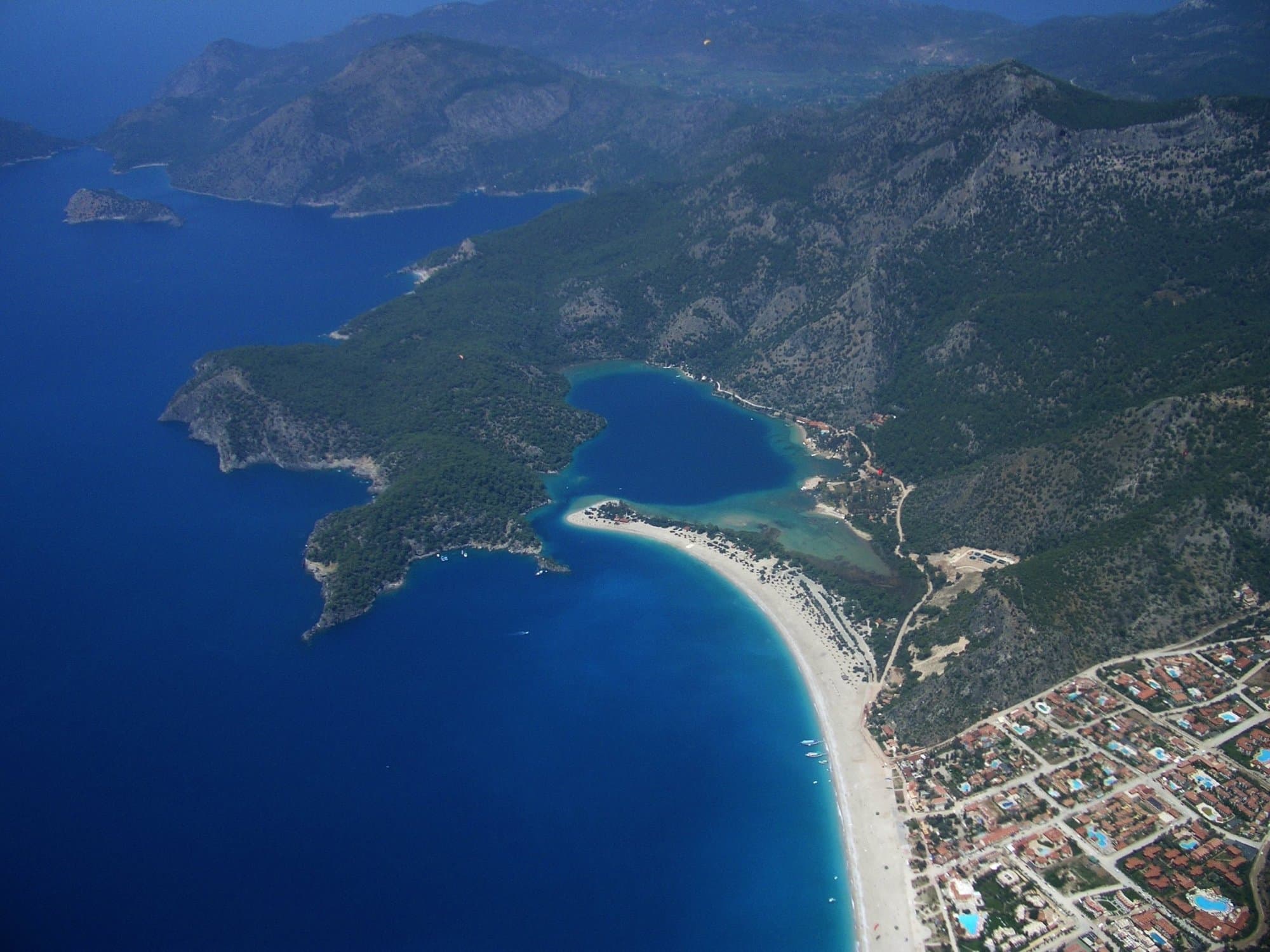
Fethiye to Ölüdeniz
23 km
A diverse first stage with pine forest paths, sea views, and an optional detour to the ghost village of Kayaköy.

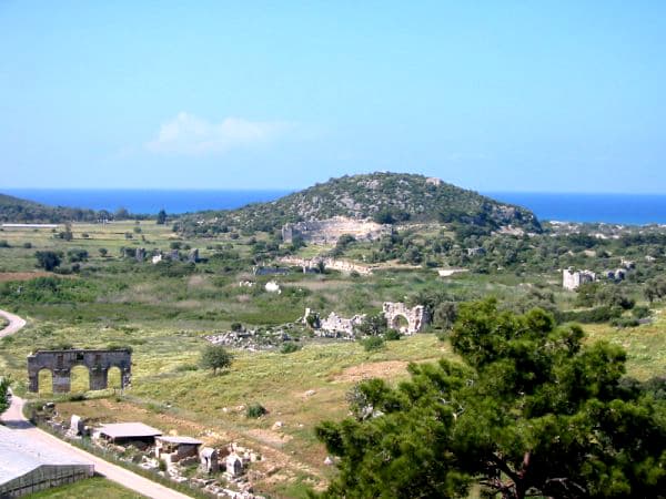

Türkiye
The Lycian Way stands as one of the world's most spectacular long-distance hiking adventures, offering outdoor enthusiasts an unforgettable journey through the ancient landscapes of Turkey's Mediterranean coast. The trail can be completed in shorter sections over multiple visits, with popular segments including Fethiye to Kaş (7-10 days) and Olympos to Antalya (5-7 days). Many hikers complete the trail in 2-3 separate trips, focusing on different sections based on available time and preferred difficulty levels.
Quick facts
Loading your progress…
A diverse first stage with pine forest paths, sea views, and an optional detour to the ghost village of Kayaköy.
A scenic coastal walk with sweeping views, steep climbs, and shady pine groves, finishing in the remote beach village of Kabak.
This more rugged stage climbs from Kabak through terraced hillsides and scattered villages, offering panoramic mountain and sea views.
From highland villages to ancient ruins and golden sands, this stage is rich in contrast and history.
Traverse coastal hills and wooded trails with views of the islands before descending into the cobbled streets of Kalkan.
The complete Lycian Way requires hiking approximately 760 kilometers (470 miles) from Hisarönü near Fethiye to Aşağı Karaman in Konyaaltı, about 20 kilometers from Antalya, creating a substantial multi-week undertaking for dedicated hikers seeking Turkey's premier long-distance trail experience. Area: Ancient Lycia region, southwestern Turkey Total Distance: 760 kilometers (470 miles) Highest Point: 2,300 meters above sea level Lowest Point: Sea level along Mediterranean coast Trail Marking: Red and white stripes following GR footpath convention Individual hiking days range from moderate 15-kilometer coastal walks to challenging 25-kilometer mountain crossings, with elevation gains varying from gentle coastal paths to steep mountain ascents exceeding 1,000 meters per day. The Lycian Way takes you from the coast to the mountains with dramatic elevation changes, making this trail accessible to experienced hikers while providing substantial challenges for even seasoned adventurers. The diverse terrain includes ancient Roman roads, mountain ridges, coastal cliffs, and rural villages, creating one of Europe's most varied long-distance hiking experiences.
The Lycian Way showcases Turkey's most spectacular Mediterranean landscapes while connecting hikers with ancient civilizations spanning over two millennia. The trail passes through numerous archaeological sites including Pinara's cliff-carved tombs, Xanthos UNESCO World Heritage Site, and the sunken city of Kekova, offering unparalleled combinations of natural beauty and historical significance. Coastal sections provide stunning views of the Mediterranean Sea with crystal-clear waters and secluded bays accessible only on foot. Mountain segments reveal dramatic limestone formations, ancient cedar forests, and panoramic vistas extending across multiple provinces. Notable highlights include the Butterfly Valley with its unique ecosystem, Patara's 20-kilometer beach and ancient ruins, and the Chimaera eternal flames near Olympos. The trail connects traditional Turkish villages where local hospitality and authentic cuisine provide cultural immersion experiences impossible to find in tourist areas.
The Lycian Way takes its name from the ancient civilization that once ruled the region, connecting modern hikers with over 2,000 years of Mediterranean history and cultural heritage. Ancient Lycia represented one of the world's first democratic federations, with sophisticated urban planning, impressive architecture, and advanced maritime trade networks that influenced Greek and Roman civilizations. The region's strategic location made it a crossroads for ancient civilizations, with Lycian, Greek, Roman, Byzantine, and Ottoman influences visible throughout the trail. The trail was conceived by British expatriate Kate Clow, who recognized the region's potential for sustainable tourism development while preserving its archaeological and natural heritage. Local communities along the route have embraced eco-tourism as an alternative to mass coastal development, creating partnerships between hikers and rural villages that support traditional lifestyles and cultural preservation. This grassroots approach demonstrates how responsible tourism can protect both natural landscapes and cultural heritage for future generations.
The Lycian Way traverses the Western Taurus Mountains, showcasing dramatic limestone formations created through millions of years of tectonic activity and Mediterranean sea-level changes. The region's complex geological history includes coral reef formations, sedimentary layers, and volcanic activity that created the diverse landscapes visible from elevated trail sections. Limestone karst topography dominates the landscape, creating the dramatic cliffs, deep canyons, and underground water systems characteristic of the Mediterranean coast. The trail crosses several distinct geological zones, from coastal terraces formed by ancient sea levels to high-altitude limestone plateaus carved by glacial activity during ice ages. These varied formations create natural amphitheaters, hidden valleys, and dramatic coastal cliffs that provide spectacular viewpoints and unique ecosystems. The region's geological diversity supports varied plant communities from Mediterranean scrubland to alpine meadows, creating habitat for numerous endemic species found nowhere else in Turkey.
Weather protection requires comprehensive preparation for Turkey's variable Mediterranean climate, from summer temperatures exceeding 40°C to winter conditions with snow at higher elevations. Lightweight, breathable clothing becomes essential during summer months, while layered systems allow adaptation to dramatic elevation changes between coastal and mountain sections. Waterproof rain gear provides protection during autumn and spring weather systems, though summer months remain relatively dry. Navigation equipment should include detailed topographic maps, GPS devices with offline capability, and compass for backup navigation during poor weather conditions. The trail is waymarked with red and white stripes, though some sections may have faded markings or require careful attention to route finding. Guidebooks specific to the Lycian Way provide essential information about water sources, accommodation options, and cultural sites along the route. Safety equipment includes comprehensive first aid supplies, emergency whistle, and reliable headlamp for early starts or late arrivals in villages. Comfortable hiking boots with good ankle support prove essential for sustained daily walking on rocky terrain and ancient stone paths. Sun protection becomes critical during summer months, while insect repellent helps manage mosquitoes in coastal areas. A sturdy backpack with proper weight distribution prevents injury during long daily distances with significant elevation changes.
The Lycian Way offers diverse accommodation options reflecting traditional Turkish hospitality and modern tourism development. Village guesthouses (pansiyon) provide authentic cultural experiences with home-cooked meals, family interaction, and local knowledge about trail conditions and cultural sites. These accommodations typically cost 200-400 Turkish Lira per night including breakfast and dinner, offering excellent value for budget-conscious hikers. Boutique hotels in coastal towns like Kaş, Kalkan, and Olympos provide luxury amenities with swimming pools, spa services, and gourmet dining featuring local specialties. Camping remains possible in designated areas and with landowner permission, though water sources and facilities may be limited in remote sections. Many hikers combine accommodation types throughout their journey, staying in guesthouses for cultural experiences and hotels for rest and resupply. Advanced booking becomes essential during peak seasons (April-June and September-October) when accommodation fills quickly, while winter months offer more flexibility and significantly lower prices. Some remote trail sections require careful planning to reach accommodation within reasonable daily distances, making flexible itineraries important for successful completion.
Food and water planning for the Lycian Way takes advantage of Turkey's excellent rural hospitality and abundant natural water sources in most sections. Village restaurants and markets provide opportunities for fresh meals and resupply, featuring local specialties including grilled fish, traditional meze, and seasonal fruits that enhance the cultural experience. Many guesthouses provide packed lunches for trail days, eliminating the need for extensive food carrying. Water sources vary significantly between coastal and mountain sections, with reliable springs and wells in most villages but potentially long dry sections in remote areas. Purification tablets or filtering systems ensure safe consumption from natural sources, though bottled water remains available in most settlements. Summer hiking requires increased water carrying capacity due to higher temperatures and longer daylight hours. Local markets in larger towns provide opportunities to purchase trail foods, camping supplies, and specialized equipment, while smaller villages offer basic necessities and authentic local products. Many hikers enjoy the social aspect of shared meals in village restaurants, creating opportunities for cultural exchange and local recommendations about trail conditions and points of interest.
Navigation on the Lycian Way follows established waymarking systems developed over the trail's 25-year history, though some sections require careful attention to route finding and map reading skills. Red and white striped markings follow the GR footpath convention, providing consistent visual guidance throughout most trail sections. However, weathering, development, and seasonal vegetation may obscure markings in some areas, making backup navigation essential. Detailed guidebooks like Kate Clow's "The Lycian Way" provide comprehensive route descriptions, cultural information, and practical advice for each trail section. Digital mapping applications offer real-time navigation and points of interest, though cellular coverage may be limited in remote mountain areas. Traditional paper maps remain valuable for overall route planning and emergency situations. Route finding becomes more complex in areas with recent development or seasonal trail closures, requiring flexibility and local knowledge. Some sections offer alternative routes for different weather conditions or trail maintenance, while others may require detours around private property or construction projects.
Lycian Way hiking presents unique safety challenges combining standard mountain hiking risks with Mediterranean-specific hazards including extreme heat, limited water sources, and remote trail sections. Summer temperatures regularly exceed 40°C, creating significant heat exhaustion and dehydration risks that require early morning starts and midday rest periods. Autumn and spring weather can change rapidly, with sudden storms creating flash flood risks in canyon sections. Trail surfaces vary from smooth ancient Roman roads to rough rocky paths that require careful foot placement and appropriate footwear. Coastal cliff sections demand attention to weather conditions and proper safety margins, while mountain sections may require route finding skills and emergency preparedness. Wildlife encounters remain rare but include venomous snakes and wild boars that require awareness and proper food storage. Medical facilities are readily available in larger towns but may be hours away from remote trail sections, making comprehensive first aid knowledge valuable for serious injuries. Turkey's emergency services provide helicopter rescue capability, though communication may be challenging in remote areas without cellular coverage.
The Lycian Way requires no special permits or advance registration, allowing maximum flexibility in timing and route planning. Most trail sections cross public lands or traditional right-of-way paths with free access, though some archaeological sites may charge modest entrance fees ranging from 20-100 Turkish Lira. Camping fees may apply in designated areas or private campgrounds near popular villages. Accommodation costs vary widely based on chosen lodging types and seasons, from budget guesthouses at 200-400 Turkish Lira to luxury hotels exceeding 2,000 Turkish Lira per night. Transportation costs apply for resupply trips or route modifications, while equipment purchases or repairs are available in larger towns along the route. Travel insurance is highly recommended for international hikers, covering medical emergencies, evacuation costs, and trip interruption. Turkey's tourism infrastructure provides excellent support for international visitors, though language barriers may complicate emergency situations in remote areas.
Lycian Way covers 100 km in total.
Most people complete Lycian Way in about 4-30 days.
The best season for Lycian Way is Spring, Fall, Winter.
Lycian Way has 5 checkpoints to log on the way to finishing it.
Keep this journey for later, or share it with someone you would like to go with.