Overland Track
crossing · point to point

Overland Track

Tasmania, Australia

About this journey

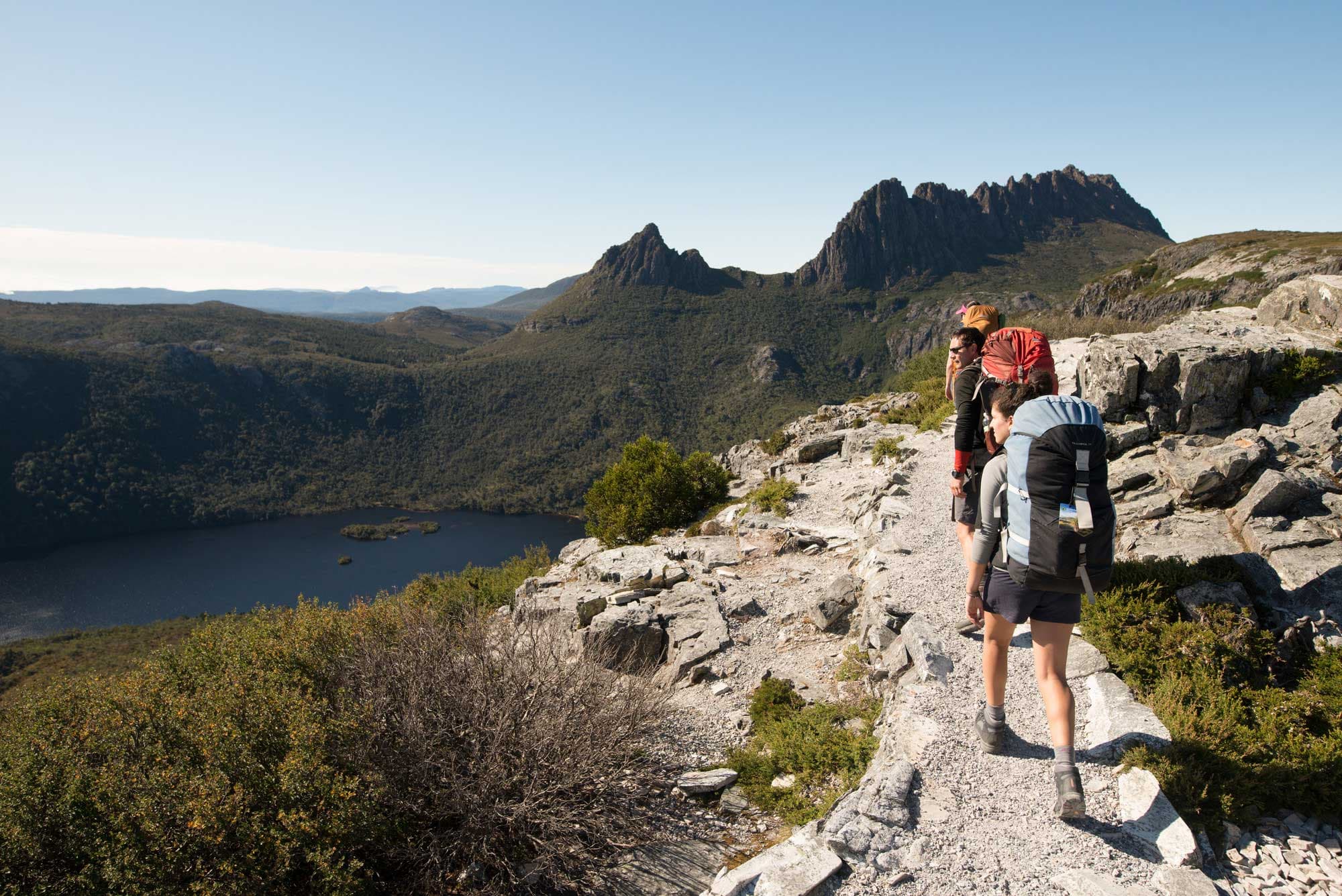
The Overland Track is Tasmania’s premier long-distance hike, spanning about 65 km through the heart of Cradle Mountain–Lake St Clair National Park. Usually completed in 6 days, the route passes through ancient rainforests, alpine moorlands, and glacial valleys, with opportunities to climb peaks like Mount Ossa (Tasmania’s highest). Daily distances range from 8–16 km, with moderate to challenging elevation changes. Many hikers extend the trek by walking the additional 17 km along Lake St Clair. The Overland Track is one of the world’s finest examples of a wilderness walk, showcasing Tasmania’s World Heritage–listed landscapes. Visitor numbers are capped with a daily permit system to preserve the wilderness. Some of the track’s plant species, like King Billy pines, are direct descendants of Gondwana flora. Cradle Mountain–Lake St Clair National Park is part of the Tasmanian Wilderness World Heritage Area, one of only a few places recognized for both natural and cultural significance.

Quick facts

stops
4located
shape
crossing
total distance
65 miles
best season
Summer
avg completion
5-7 days

Loading your progress…

loading map…

The journey, stop by stop

stop 1 of 4
photo not yet sourced

Ronny C​​reek to Lake Windermere​

The Overland Track begins at Ronny Creek in Cradle Mountain–Lake St Clair National Park, where boardwalks guide you through alpine meadows and ancient rainforest. The climb toward Marion’s Lookout offers sweeping views of Cradle Mountain and Dove Lake, an iconic start to the journey. From there, the trail rolls across open alpine plateaus with scattered tarns and wildflowers before reaching Lake Windermere. The campsite here is beautifully set by the water, a tranquil end to the first stage.

stop 2 of 4
photo not yet sourced

Lake Windermere to Kia Ora

Leaving Lake Windermere, the track weaves through button grass plains and mossy forests, with Mount Pelion West looming in the distance. This stage offers some of the trail’s most dramatic alpine panoramas, including sweeping views from Pelion Gap. Weather permitting, side trips to Mount Ossa, Tasmania’s highest peak, reward hikers with unmatched vistas across the island’s wild heart. Descending from the gap, the path enters rich myrtle and sassafras forest before reaching Kia Ora Hut.

stop 3 of 4
photo not yet sourced

Kia Ora​​ to Windy Ridge (Bert Nichols Hut)

This section of the Overland Track is defined by ancient rainforest and cascading waterfalls. From Kia Ora, the trail passes Du Cane Hut, an old trappers’ shelter, then continues through mossy valleys framed by towering King Billy pines and myrtles. The optional waterfall side trips—Fergusson, D’Alton, and Hartnett Falls—are must-sees, especially after rain. After soaking in the forest atmosphere, the track climbs gradually to Du Cane Gap before descending toward Windy Ridge.

stop 4 of 4
photo not yet sourced

Windy Ridge (Bert Nichols Hut) to Cynthia Bay

The final stage leads from Windy Ridge through quiet eucalypt forest and heathland toward the shores of Lake St Clair, Australia’s deepest natural lake. The trail gradually softens, leaving behind alpine peaks for gentler terrain and glimpses of water through the trees. Many hikers choose to end at Narcissus Hut and take the ferry across the lake, while others walk the full distance to Cynthia Bay.

History

The route follows ancient Aboriginal pathways that connected hunting and resource grounds. Modern hiking began in the 1930s, when Austrian Gustav Weindorfer advocated for public access to this wilderness. Geologically, the trail highlights Jurassic dolerite columns, remnants of ancient volcanic activity, alongside glacial valleys and lakes carved during the ice ages. Pencil pines more than 1,000 years old grow in the alpine zones, making the trail a living museum of prehistoric ecosystems.

Safety

Essential gear for the Overland Track must handle Tasmania's notoriously changeable mountain weather, where temperatures ranging from hot (in excess of 35 °C or 95 °F) in summer to below 0 °C (32 °F) in winter. Snow can fall at any time and is common during the winter, especially on the Cradle Mountain Plateau and around Mount Ossa.  Essential gear includes waterproof boots, rain gear, insulating layers, and reliable shelter. Navigation is generally straightforward due to excellent trail markings, but fog and storms can reduce visibility. Hikers must carry all food, as there are no resupply points along the track. Lightweight, high-energy meals such as dehydrated food, trail mix, and muesli bars are recommended. Stoves are required, as open fires are prohibited to protect fragile alpine environments. Water is plentiful from streams and lakes but should be treated for safety.

Permits

Overland Track permit is available from Tasmania National Parks and is required for the period October to May. For other months no permit is needed with current pricing showing some variation in sources. Remember the price is $285 per person.  The Overland Track is supported by a network of basic huts spaced along the route, including Waterfall Valley, Windermere, Pelion, Kia Ora, and Narcissus. These huts provide sleeping platforms, rainwater tanks, and simple cooking areas, but no heating or electricity. Reservations are required, especially in peak season. Camping platforms are available at each hut site for hikers carrying tents.

Overland Track: common questions

How long is Overland Track?

Overland Track covers 65 miles in total.

How long does Overland Track take to complete?

Most people complete Overland Track in about 5-7 days.

When is the best time to do Overland Track?

The best season for Overland Track is Summer.

How many checkpoints does Overland Track have?

Overland Track has 4 checkpoints to log on the way to finishing it.

Plan your journey.

Keep this journey for later, or share it with someone you would like to go with.