

Challenge
Pemigewasset Loop
New Hampshire, United States
About this challenge
The Pemigewasset Loop represents New Hampshire's ultimate hiking challenge, combining 31 miles of spectacular White Mountain terrain with eight coveted 4,000-foot summits in one epic adventure. This legendary loop attracts serious hikers nationwide with its promise of extended above-treeline ridge walks, including the famous Franconia Ridge traverse, and breathtaking wilderness views across multiple states. Typically completed over 2-3 days with 9,000+ feet of elevation gain, the Pemi Loop tests endurance while delivering unmatched mountain scenery through pristine wilderness.
Quick facts
- Checkpoints
- 11
- Distance
- 32 miles
- Avg Completion
- 4-5 days
- Best Season
- Summer, Spring, Fall
Overview
The Pemigewasset Loop stands as the crown jewel of New Hampshire's White Mountain National Forest, offering one of the Northeast's most challenging and rewarding multi-day hiking adventures. This legendary loop trail attracts serious backpackers and ambitious day hikers from across the country, drawn by its promise of spectacular above-treeline ridge walks, pristine wilderness views, and the opportunity to summit eight of New Hampshire's coveted 4,000-foot peaks in a single epic journey. The "Pemi Loop" has earned its reputation as a bucket-list hike that tests endurance while delivering some of the most dramatic mountain scenery the White Mountains have to offer.
Trail Statistics and Elevation
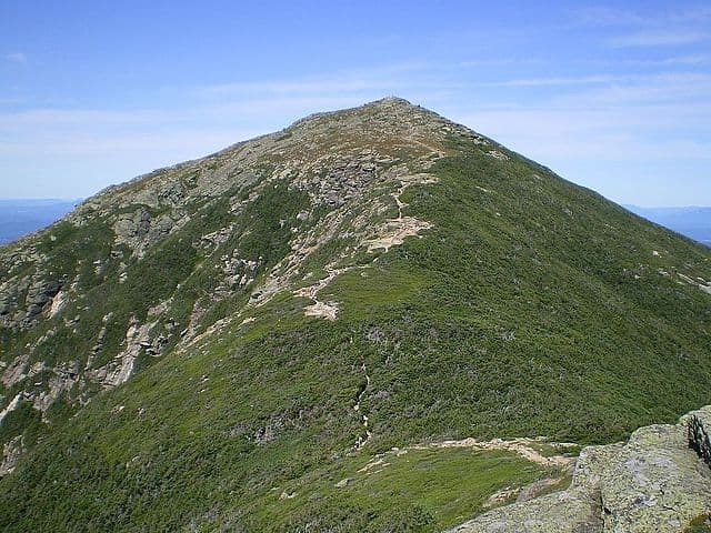
The complete Pemigewasset Loop covers approximately 31-32 miles with total elevation gain ranging from 9,000 to 11,000 feet, creating a substantial multi-day undertaking that typically requires 2-4 days to complete safely. The loop can be tackled as an ambitious single-day challenge by ultra-experienced hikers, though most adventurers prefer the 2-3 day backpacking approach to fully appreciate the spectacular scenery and manage the physical demands. Elevation Gain: 9,000-11,000 feet total Standard 4,000-footers: 8 peaks (Flume, Liberty, Lincoln, Lafayette, Garfield, South Twin, Bond, Bondcliff) Optional Peaks: West Bond, Galehead, Mount Guyot (adds 2-3 miles) Highest Point: Mount Lafayette at 5,260 feet The standard route includes eight 4,000-footers: Flume, Liberty, Lincoln, Lafayette, Garfield, South Twin, Bond, and Bondcliff, though experienced hikers often add bonus peaks like West Bond for additional challenge. Individual summit approaches range from moderate ridge walks to steep, technical scrambles, with the famous Franconia Ridge traverse offering nearly 3 miles of exposed above-treeline hiking with 360-degree views.
Highlights and Landmarks
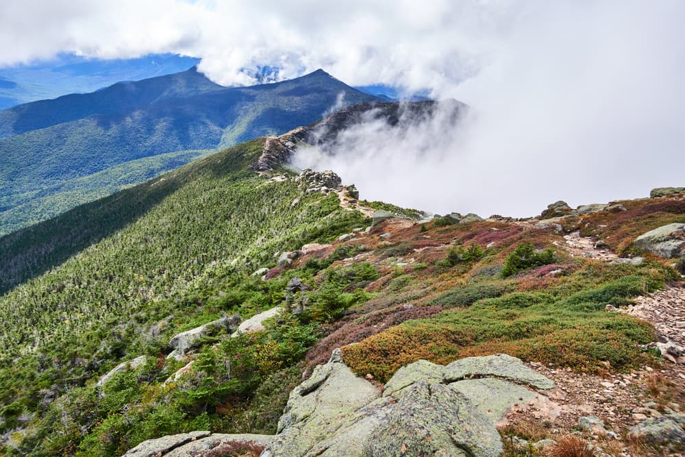
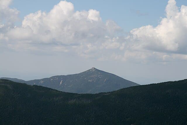
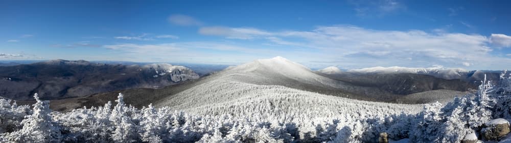
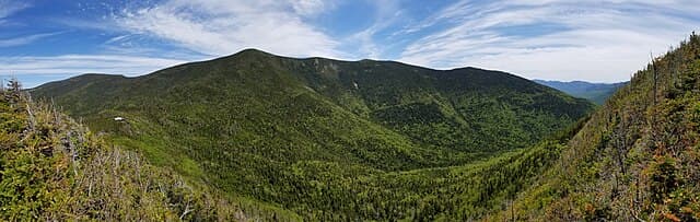
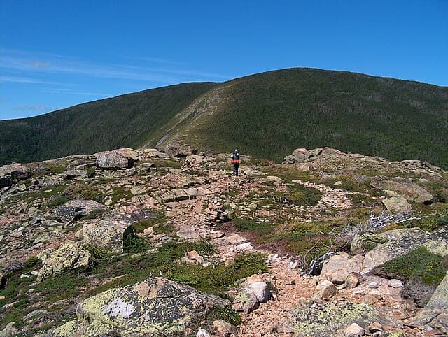
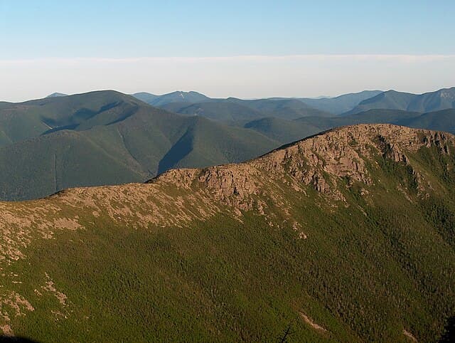
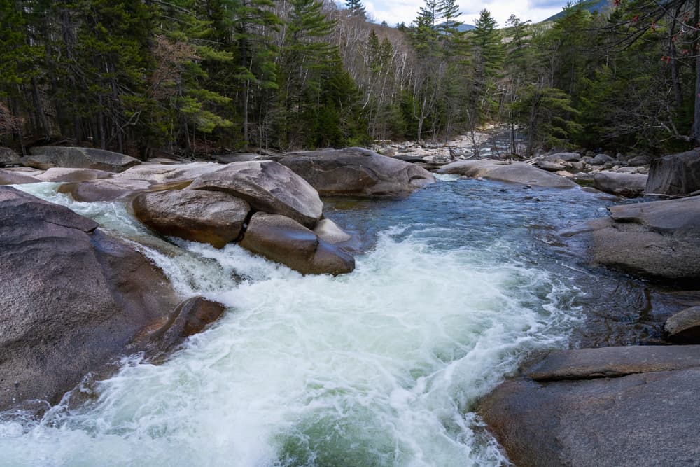
The Pemi Loop features long stretches of above-treeline hiking, including the Franconia Ridge Traverse and the Bonds Traverse, showcasing two of New Hampshire's most spectacular high-altitude experiences. The Franconia Ridge section connects Lincoln, Lafayette, and surrounding peaks via knife-edge ridgelines with dramatic drops on both sides, while the remote Bonds Traverse offers a wilder, more isolated mountain experience with expansive wilderness views. The loop's diverse terrain includes everything from gentle riverside walking along the East Branch Pemigewasset River to challenging rock scrambles near summit approaches. Notable landmarks include the iconic Franconia Ridge with its weather station and summit cairns, the remote Bond-Bondcliff col with sweeping views into the Pemigewasset Wilderness, and the peaceful Wilderness Trail section that provides welcome relief after demanding ridge walks. Key viewpoints offer panoramic vistas extending across multiple states, with clear-day visibility reaching Vermont's Green Mountains, Maine's western peaks, and the entire Presidential Range. The contrasting landscapes - from dense boreal forests to alpine zones above treeline - showcase the incredible ecological diversity packed into this compact wilderness area.
Cultural and Historical Context
The Pemigewasset Loop traverses lands with deep connections to New England's logging and conservation history. The Pemigewasset Wilderness, established in 1984, protects 45,000 acres of recovered forestland that was extensively logged during the late 1800s and early 1900s. The East Branch & Lincoln Railroad transported massive timber harvests through this valley, leaving behind railroad grades that now serve as comfortable hiking trails. The transformation from industrial logging site to pristine wilderness represents one of New England's greatest conservation success stories. Today's hikers follow paths that once carried locomotives, walking through mature second-growth forests that have recovered magnificently over the past century. This history adds profound meaning to the wilderness experience, demonstrating nature's remarkable ability to heal when given protection and time. The Appalachian Mountain Club's hut system, including Greenleaf and Galehead Huts accessible from the loop, continues a century-old tradition of supporting mountain recreation while maintaining minimal environmental impact. These historic structures represent the collaborative spirit between recreation and conservation that defines White Mountain culture.
Geology
The Pemigewasset Loop showcases the geological complexity of New Hampshire's White Mountains, formed through multiple mountain-building episodes over hundreds of millions of years. The route crosses ancient metamorphic rocks, primarily schists and gneisses, that were folded and uplifted during the Acadian Orogeny approximately 400 million years ago. The dramatic peaks surrounding the Pemigewasset Basin display classic glacial sculpting, with U-shaped valleys, cirques, and knife-edge ridges carved during multiple ice ages. The most recent glaciation ended roughly 12,000 years ago, leaving behind the sharp ridgelines and steep-walled valleys that create today's spectacular hiking terrain. Bedrock composition varies throughout the loop, with resistant granite and schist formations creating the highest peaks while softer rocks form the valley bottoms. This geological diversity produces the dramatic elevation changes and varied landscapes that make the Pemi Loop such a compelling hiking experience, from riverside walking to technical rock scrambling above treeline.
Essential Gear
Weather protection requires comprehensive layering systems capable of handling rapid mountain weather changes, particularly during extended above-treeline exposure on the Franconia Ridge and Bonds traverses. Waterproof shell jackets and pants become essential for sudden storms, while insulating layers allow adaptation to temperature variations from valley floors to exposed summits. Navigation equipment should include detailed White Mountain trail maps, compass, and GPS device with offline mapping capability for areas with limited cellular coverage. While the Pemi Loop follows well-established trails with good signage, backup navigation prevents problems during poor visibility conditions common above treeline. Safety equipment includes comprehensive first aid supplies, emergency whistle, reliable headlamp with extra batteries, and emergency shelter for unexpected weather delays. Trekking poles prove invaluable for steep descents and river crossings, particularly during spring snowmelt or after heavy rains. Sun protection becomes critical during extended above-treeline travel where UV radiation intensifies with elevation. Footwear should prioritize ankle support and aggressive tread for technical rock sections and potentially wet conditions. Waterproof boots or trail runners with gaiters help manage stream crossings and morning dew on vegetation throughout the diverse terrain.
Food and Water
Food planning for the Pemi Loop requires careful consideration of weight versus nutritional needs during the demanding multi-day effort. Calorie-dense options like nuts, dried fruits, energy bars, and dehydrated meals provide necessary fuel while minimizing pack weight during extended climbing sections. Most hikers require 3,000-4,000 calories daily during active hiking days. Water sources vary significantly throughout the route, with reliable streams and springs available in most sections but requiring purification for safe consumption. The Wilderness Trail section offers easy water access along the East Branch Pemigewasset River, while high ridgeline sections may require carrying water between distant sources. Spring and fall hiking may encounter frozen water sources at higher elevations. Resupply opportunities exist at AMC huts for hikers utilizing these services, though most backpackers carry all food for the complete loop. Careful meal planning prevents carrying unnecessary weight while ensuring adequate nutrition for the sustained physical effort required throughout the challenging route.
Accommodation and Booking
The Pemi Loop offers flexibility in accommodation approaches, from ambitious single-day attempts to comfortable 3-4 day backpacking trips with strategic camping locations. Two AMC huts provide excellent overnight options: Greenleaf Hut near Mount Lafayette and Galehead Hut near Mount Galehead, offering beds, meals, and full-service mountain hospitality. Backcountry camping follows Leave No Trace principles with established campsites and tent platforms available at designated locations. Popular camping areas include Garfield Ridge campsite, Liberty Spring tentsite, and Guyot campsite, though advance reservations are recommended during peak hiking seasons. These locations provide strategic breaks in the route while minimizing environmental impact. Base camping options include the Lincoln Woods area with nearby lodging in North Woodstock and Lincoln, allowing day-trip access to portions of the loop. Many hikers prefer splitting the route into sections over multiple weekends, using comfortable accommodations to recover between challenging segments.
Safety and Risk Management
Pemi Loop hiking presents significant safety challenges combining standard mountain hiking risks with specific hazards from extended above-treeline exposure and remote wilderness locations. Weather exposure increases dramatically during the Franconia Ridge and Bonds traverses, where afternoon thunderstorms create dangerous lightning conditions and sudden temperature drops can lead to hypothermia. Emergency evacuation from remote sections of the loop can require hours of hiking to reach road access, making self-rescue capabilities and preventive safety measures essential. Carrying emergency communication devices like satellite messengers provides backup contact options in true emergency situations, though cellular coverage remains limited throughout most of the route. Seasonal considerations include spring conditions with lingering snow and ice above treeline requiring microspikes or crampons, summer afternoon thunderstorm risks during exposed ridge walks, and fall weather volatility with potential for early winter conditions. Winter attempts require extensive mountaineering experience and specialized cold-weather equipment for safe completion.
Permits and Fees
The Pemigewasset Loop requires no special hiking permits beyond standard White Mountain National Forest access, though overnight camping at designated sites requires small fees typically ranging from $5-10 per person per night. AMC hut stays require advance reservations with rates varying by season and accommodation type, generally ranging from $50-150 per person depending on meal packages. Parking fees apply at Lincoln Woods Trailhead with daily rates around $5 during peak seasons, though annual passes provide economical options for frequent White Mountain visitors. These fees support trail maintenance, facility improvements, and conservation programs throughout the National Forest system.
Navigation
Navigation on the Pemi Loop follows well-established trail systems with standard White Mountain blazing and signage, though careful attention to trail junctions prevents wrong turns that could add significant mileage. The loop typically follows the Appalachian Trail for major sections, providing excellent trail maintenance and clear marking systems. Critical navigation points include the Lincoln Woods trailhead approach, Franconia Ridge connections, and the Bond-Bondcliff traverse where weather conditions can reduce visibility significantly. Detailed guidebooks like the AMC White Mountain Guide provide specific route descriptions, mileage breakdowns, and current trail condition updates essential for successful navigation. Above-treeline sections require particular attention during poor weather conditions when cairns and blazes may become difficult to follow. GPS coordinates for key trail junctions and emergency escape routes provide backup navigation options when visibility drops below safe levels for continued hiking.
Featured checkpoints
Lincoln Woods trailhead
Lincoln, New Jersey, United States
Mount Flume
White Mountains, NH
Mount Liberty
White Mountains, NH
Mount Lincoln
White Mountains
Mount Lafayette
White Mountains, NH
Garfield Mountain
White Mountains, NH
All stops on this route
Pemigewasset Loop: common questions
How long is Pemigewasset Loop?
Pemigewasset Loop covers 32 miles in total.
How long does Pemigewasset Loop take to complete?
Most people complete Pemigewasset Loop in about 4-5 days.
When is the best time to do Pemigewasset Loop?
The best season for Pemigewasset Loop is Summer, Spring, Fall.
How many checkpoints does Pemigewasset Loop have?
Pemigewasset Loop has 11 checkpoints to log on the way to finishing it.