

Challenge
Hadrian's Wall Path
England, United Kingdom
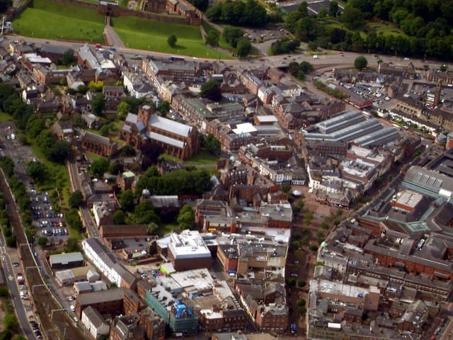
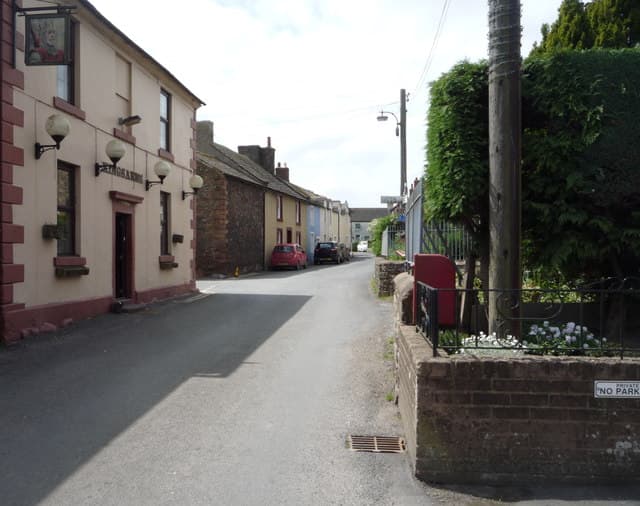
About this challenge
Step into the footsteps of Roman legions on Britain's most historic hiking adventure. The 84-mile Hadrian's Wall Path takes you coast-to-coast across northern England, following the ancient frontier that once marked the edge of the Roman Empire. This spectacular National Trail combines dramatic countryside, fascinating archaeology, and rich cultural heritage into an unforgettable 6-7 day journey. Walk along towering crags with panoramic views, explore world-class Roman forts and museums, and experience the wild beauty of Northumberland's landscapes. From the bustling streets of Newcastle to the tranquil shores of the Solway Firth, every mile tells the story of emperors, soldiers, and the people who shaped Britain's history.
Quick facts
- Checkpoints
- 7
- Distance
- 135 km
- Avg Completion
- 6-9 days
- Best Season
- Summer, Spring, Fall
Overview
Hadrian's Wall Path stands as one of Britain's most iconic and historically significant long-distance hiking adventures, offering outdoor enthusiasts an unforgettable journey across the dramatic landscapes of northern England. This National Trail follows the route of the ancient Roman frontier, inviting hikers to walk coast-to-coast along what was once the northernmost boundary of the Roman Empire. The path attracts thousands of dedicated walkers annually who seek to experience stunning countryside vistas, rich archaeological sites, and the profound historical significance of this UNESCO World Heritage Site that defines England's Roman heritage. The complete Hadrian's Wall Path stretches 84 miles (135 kilometers) from coast to coast across northern England, creating a substantial week-long undertaking for dedicated hikers. The trail runs from Wallsend in Newcastle upon Tyne on the east coast to Bowness-on-Solway in Cumbria on the west coast.
Statistics and Elevation Profile
Area: Northern England (Northumberland, Cumbria, and Tyne and Wear) Total Distance: 84 miles (135 kilometers) Highest Point: Winshields Crags at 1,230 feet (375 meters) elevation Lowest Point: Sea level at both coastal endpoints Individual daily stages range from comfortable 10-mile walks to challenging 20-mile stretches, with elevation gains varying from gentle rolling hills to steep climbs over the dramatic Whin Sill escarpment. The most challenging section runs through the central Northumberland countryside, where the trail climbs over rocky crags and offers the most spectacular views. The diversity of terrain makes this path accessible to hikers of various experience levels while still providing substantial rewards for seasoned adventurers.
Highlights and Landmarks
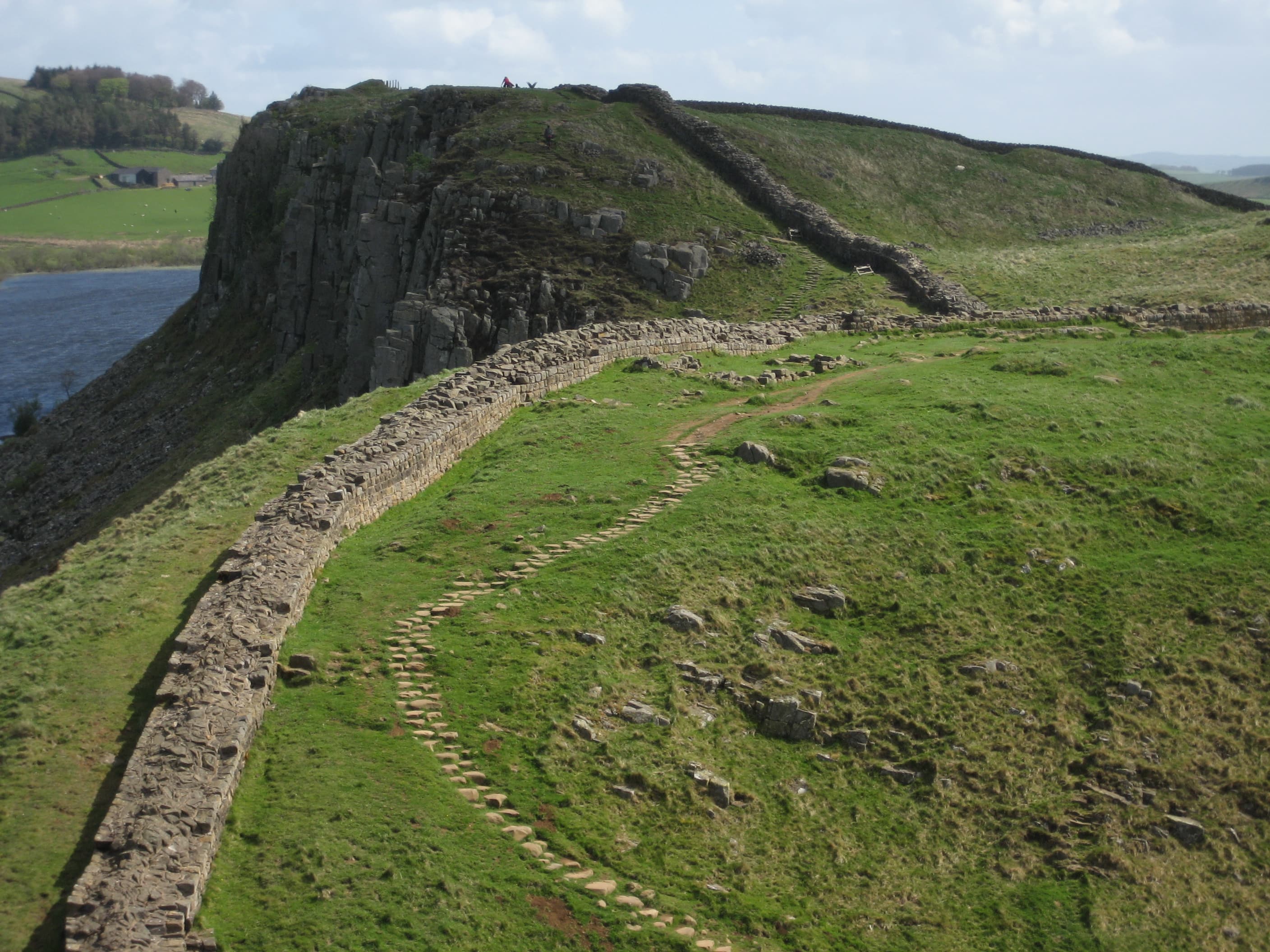
The Hadrian's Wall Path showcases northern England's most spectacular and diverse landscapes across three distinct counties. The trail passes through quintessential English countryside, dramatic moorland, and charming market towns, while following the course of the ancient Roman Wall for much of its length. Historic Roman sites represent the trail's crown jewels, with well-preserved forts, museums, and archaeological sites providing insights into Roman military life and engineering prowess. Notable landmarks include Housesteads Roman Fort with its impressive remains and visitor center, Vindolanda with its ongoing excavations and world-class museum, and the dramatic Sycamore Gap (though the famous tree was sadly felled in 2023, the location remains a powerful landmark). The central section along the Whin Sill offers the most dramatic walking, with the trail undulating over rocky crags that provide panoramic views across the Northumberland countryside. Steel Rigg, Highshield Crags, and Peel Crags offer some of the most photographed viewpoints along the entire National Trail network.
Culture and History
The Hadrian's Wall Path connects hikers with nearly 2,000 years of British history, following the route of the Roman Empire's most ambitious defensive structure. Built beginning in AD 122 under Emperor Hadrian's orders, the wall originally stretched 73 miles and stood up to 20 feet high, complete with forts, milecastles, and turrets that housed thousands of Roman soldiers. The wall served as more than just a military barrier; it represented the edge of the civilized Roman world and controlled trade and movement between the Roman province of Britannia and the unconquered Caledonian tribes to the north. Walking the path today allows hikers to experience this frontier landscape much as Roman soldiers would have seen it, though with considerably more comfort and safety. The preservation and interpretation of Hadrian's Wall represents one of Britain's greatest archaeological achievements, with English Heritage, the National Trust, and local communities working together to maintain both the ancient monuments and the modern walking trail. This collaborative stewardship demonstrates how historical preservation and outdoor recreation can work together to protect cultural heritage for future generations.
Geology
The Hadrian's Wall Path traverses fascinating geological terrain that tells the story of ancient volcanic activity and glacial sculpting across northern England. The dramatic central section follows the Whin Sill, a geological formation created by molten rock (dolerite) that was injected between existing rock layers around 295 million years ago. This hard volcanic rock resisted erosion better than surrounding limestone and sandstone, creating the distinctive ridge of cliffs and crags that made this location strategically perfect for Roman military engineers. The Romans recognized that building their wall along this natural defensive barrier would maximize their military advantage while minimizing construction challenges. The eastern and western sections of the trail cross different geological formations, including Carboniferous limestone that creates the rolling agricultural landscape of the Eden Valley and the coal measures that supported centuries of mining activity around Newcastle. Glacial activity during the Ice Ages carved the valleys and deposited the boulder clay that creates much of the area's fertile farmland.
Essential Gear
Weather protection requires comprehensive layering systems capable of handling the notoriously changeable British weather, from warm sunny days to cold, wet conditions with strong winds. Waterproof jackets and trousers become essential equipment, as the exposed sections along the Wall offer little shelter from sudden weather changes. Insulating layers allow adaptation to temperature variations throughout the day and between seasons. Navigation equipment should include detailed Ordnance Survey maps, compass, and GPS devices with offline mapping capability for areas with limited mobile phone coverage. The Hadrian's Wall Path is generally well-marked with distinctive acorn waymarkers, but backup navigation prevents problems when markers become obscured or damaged. Safety equipment includes comprehensive first aid supplies, emergency whistle, and reliable headlamp with extra batteries for early starts or unexpected delays. Trekking poles prove valuable for the rocky sections and steep descents, particularly when paths become slippery in wet conditions. Sun protection becomes important on exposed sections, while warm hat and gloves are essential for cooler months. Quality hiking boots with good ankle support and grip are crucial for the varied terrain, from paved paths through towns to rocky scrambles over the crags. Gaiters help keep debris out of boots during muddy sections, which can be extensive after rain.
Accommodation
The Hadrian's Wall Path offers excellent accommodation diversity, allowing hikers to choose from camping, B&Bs, inns, hotels, or youth hostels based on personal preferences and budget. The trail is well-served by accommodation providers who understand the needs of long-distance walkers, with many offering luggage transfer services, packed lunches, and early breakfast options. Booking accommodations well in advance is essential, particularly for peak season (May through September) and weekends. Many of the most convenient accommodations have limited capacity, and the trail's popularity means that last-minute bookings can be difficult or impossible. Planning accommodation locations determines daily walking distances, so early booking allows for optimal itinerary planning. B&Bs and small inns provide the classic Hadrian's Wall Path experience, with warm hospitality, hearty breakfasts, and local knowledge from hosts who often have decades of experience helping walkers. Many accommodation providers offer luggage transfer services through companies like Sherpa Van Project, allowing hikers to walk with just day packs. YHA hostels at Once Brewed and Greenhead provide budget-friendly options with good facilities, while camping is available at several locations along the route. Wild camping is not permitted along most of the trail, so advance planning for camping spots is essential.
Food and Water
Food and water planning for the Hadrian's Wall Path benefits from the trail's excellent infrastructure, with regular opportunities to resupply in villages and towns along the route. Most accommodations provide substantial breakfasts that can fuel morning walking, while many also offer packed lunch services for an additional fee. The trail passes through or near numerous villages with pubs, cafes, and shops, including Corbridge, Hexham, Haltwhistle, and Brampton. These communities provide excellent opportunities for hot meals, local specialties, and cultural experiences that enhance the overall walking experience. Traditional pub meals and local Northumbrian specialties add flavor to the journey. Water sources are generally reliable along the trail, with taps available at visitor centers, pubs, and accommodations. Carrying capacity for 1-2 liters should be sufficient for most sections, though carrying extra water is wise for the more remote central sections during hot weather.
Navigation
Navigation on the Hadrian's Wall Path is generally straightforward, with the trail well-marked using the distinctive National Trail acorn symbol and specific Hadrian's Wall Path waymarkers. The route follows established footpaths, bridleways, and minor roads for most of its length, with clear signage at junctions and decision points. The most challenging navigation occurs in towns and cities, where the trail route can be complex as it weaves through urban areas. Wallsend, Newcastle, and Carlisle require particular attention to waymarking, as the trail follows streets, parks, and riverside paths that may not be immediately obvious. Detailed guidebooks provide invaluable support for navigation and trip planning, with recommended resources including the official National Trail guide and various commercial guidebooks that offer different perspectives on route options, accommodation, and points of interest.
Permits and Fees
Mobile phone apps with offline mapping capability provide excellent backup navigation, though battery management becomes important during longer walking days. The trail generally has good mobile phone coverage, but some remote sections may have limited signal. Hadrian's Wall Path presents moderate safety challenges typical of British hill walking, with weather exposure being the primary concern. The exposed sections along the Wall crags can be particularly hazardous during high winds, ice, or fog, when visibility becomes severely limited and footing becomes treacherous. Seasonal considerations include shorter daylight hours during winter months, when completing longer sections becomes challenging and weather conditions are most severe. Summer brings the best weather but also the highest trail traffic, requiring patience at popular viewpoints and archaeological sites. The rocky sections along the Whin Sill require careful attention to foot placement, particularly when wet conditions make rock surfaces slippery. Some sections involve steep climbs and descents that can be physically demanding and require reasonable fitness levels. Traffic awareness is important where the trail follows or crosses roads, particularly the busy A69 and various minor roads throughout the route. High-visibility clothing helps ensure safety during road crossings and sections that follow roadways. The Hadrian's Wall Path requires no special permits or fees for hiking, as it follows established public rights of way across public and private land. However, visiting the major Roman sites along the route requires separate admission fees, which can add significantly to the overall cost of the journey. English Heritage manages most of the major Roman sites, including Housesteads, Birdoswald, and Corbridge, with admission fees typically ranging from £8-15 for adults. Annual English Heritage membership provides economical access for visitors planning to see multiple sites and supports conservation efforts. Parking fees apply at some locations for those doing day walks or section hiking, typically ranging from £3-8 daily at popular car parks. Some accommodations include parking in their rates, while others charge additional fees for secure parking. National Trust membership provides access to some sites and car parks along the route, while supporting conservation efforts that maintain the landscapes and heritage sites that make the Hadrian's Wall Path such a remarkable walking experience.
Featured checkpoints
Newcastle to Tyneside
Newcastle South, Newcastle, County Dublin, Ireland
Tyneside to East Wallhouses
Tyneside Road, Newcastle upon Tyne, NE4 7AD, United Kingdom
East Wallhouses to Chollerford
Wallhouse Road, Ross-on-Wye, HR9 7ES, United Kingdom
Chollerford to Haltwhistle
Steel Rigg, Hexham, NE47 7AW, United Kingdom
Haltwhistle to Gilsland
Haltwhistle, Northumberland, England, United Kingdom
Gilsland to Carlisle
Gilsland, Northumberland, England, United Kingdom
All stops on this route
Hadrian's Wall Path: common questions
How long is Hadrian's Wall Path?
Hadrian's Wall Path covers 135 km in total.
How long does Hadrian's Wall Path take to complete?
Most people complete Hadrian's Wall Path in about 6-9 days.
When is the best time to do Hadrian's Wall Path?
The best season for Hadrian's Wall Path is Summer, Spring, Fall.
How many checkpoints does Hadrian's Wall Path have?
Hadrian's Wall Path has 7 checkpoints to log on the way to finishing it.