
Theth to Valbona in October: Can You Hike the Pass?
Can you hike Theth to Valbona in October? Check pass conditions, guesthouses and the Komani ferry, and plan an Albanian Alps alternative if snow arrives.

Hike List
Posted on 12 Oct, 2026
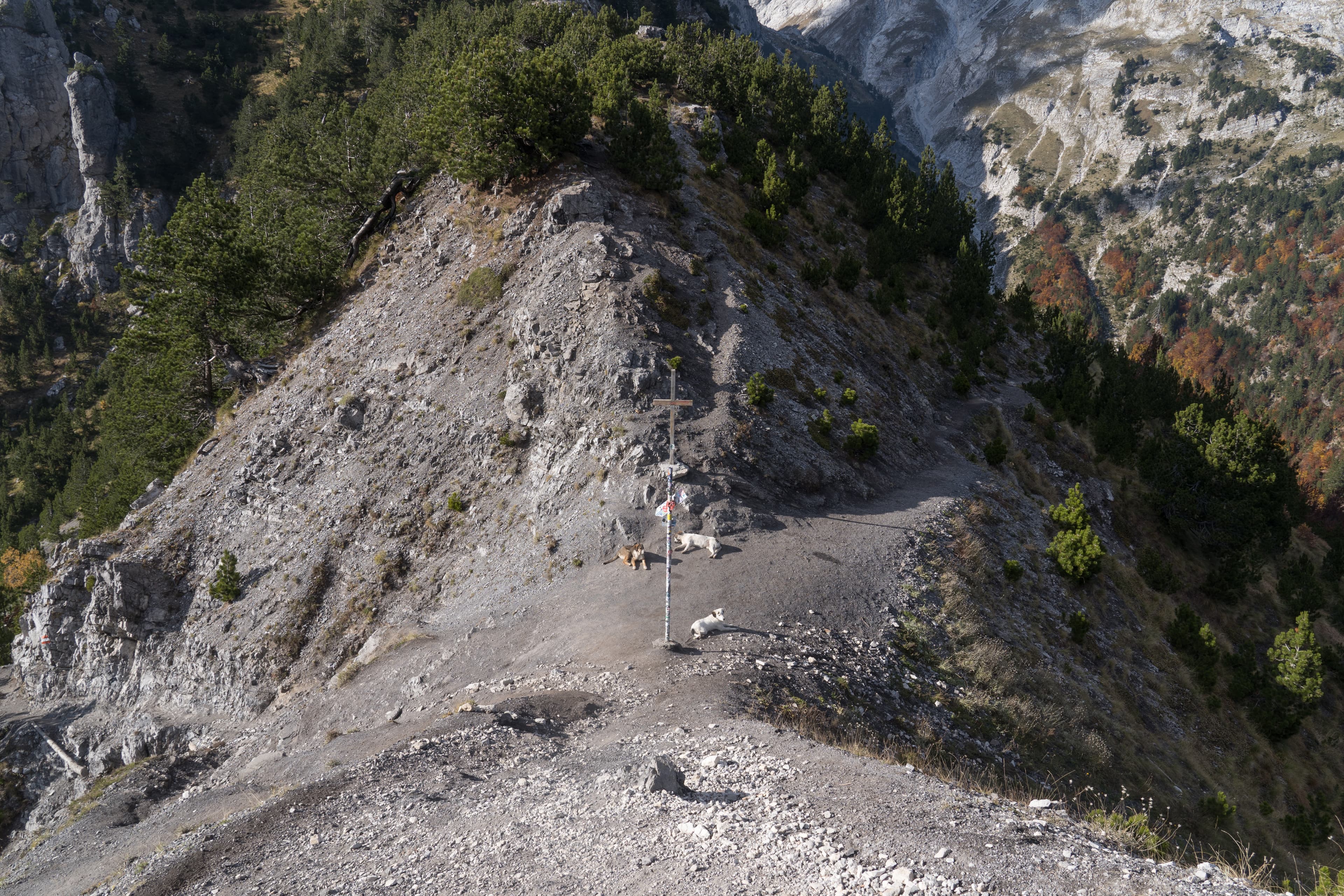
Hero photograph: Valbona Pass on 14 October 2024. Alexkom000 / Wikimedia Commons, CC BY 4.0. Displayed to fit the page; this historical image does not show current trail conditions.

October can be a beautiful month to visit the Albanian Alps. But visiting Theth or Valbonë is not the same decision as hiking over the high pass between them.
The answer: you may be able to hike it in suitable conditions, but you cannot assume an October crossing is safe. Ask locally about recent snow and ice at the pass, check mountain weather, and keep an alternative that does not rely on crossing.
How far is the Theth to Valbona crossing?
The Peaks of the Balkans project's stage description lists 13.9 km, with 1,068 m of ascent, a 1,759 m high point, and an estimated seven hours. Its finish is at Fusha e Gjes Hotel, with Valbonë center another 3.5 km along the road. Other published distances often use different endpoints. Before relying on a number, locate your exact guesthouse and trailhead on an offline map.
These figures describe that published Theth-to-Valbonë stage, not every guesthouse-to-guesthouse walk. They are not a promise of walking time or current trail condition. The source is an older route description, not a live advisory.
Is October too late to hike the pass?
It depends on the specific day, recent weather and your skills. Regional trekking-operator guidance warns of shoulder-season snowfall, guesthouses that may not be open and shorter days in October. A clear valley does not prove the high pass is clear.
As of 12 October 2026, no live same-day pass condition report has been verified for this article. Before committing, ask a guesthouse or local guide on either side whether people have crossed recently, where snow or ice remains, and whether visibility and footing are suitable. Check forecasts for pass elevation as well as the valleys. If the route is uncertain or conditions exceed your experience and equipment, do not start.
Carry offline navigation, extra layers, food, water, a headlamp and backup power. Do not depend on seasonal cafés or phone signal. Tell someone your expected route and arrival.
Does the Komani Lake ferry run in October?
A ferry timetable does not tell you whether the mountain pass is walkable. On 12 October 2026, operator Berisha's published timetable listed Koman–Fierzë service from 15 April to 5 November, advertising 09:00 from Koman and 13:00 from Fierzë.
These are scheduled services, not confirmed departures for your date. Check directly, including your road transfers. A ticket for the lake is not a report on snow in the mountains.
If conditions are suitable, plan the loop as separate days: Shkodër → Koman → ferry to Fierzë → Valbonë; next day over the pass to Theth; following day back to Shkodër by road. Reverse it if your verified connections work better. In October, allow a weather buffer rather than forcing the crossing before a flight.
Use Wyld Quest's Komani–Valbona–Theth map and itinerary to compare the ferry-first and mountains-first sequences. Its dotted connections show the order of places, not a navigable trail or driving route. Use a current offline trail map for the crossing and confirm transfers separately.
What can you do if the pass is unsuitable?
Stay in Theth and explore the village or a shorter local path if conditions allow. Wyld Quest's Theth Heritage Loop gives place context, not a live navigation clearance. Or stay in Valbonë and ask a local host for an appropriate valley walk.
You could also ride Komani Lake separately, if the ferry and both land transfers are operating. None of these alternatives should be assumed open without checking. Confirm a return plan that does not depend on walking over the pass.
For broader routes, see Wyld Quest's Via Dinarica challenge and Balkan hiking guide.
The better October trip isn't necessarily the one that crosses the pass. It's the one that lets you experience the mountains without pretending their weather runs on a timetable.
Sources checked 12 October 2026. This is planning guidance, not a live trail advisory.